 STORIES & GUIDES
Cycling, fishing, or canyoning. Discover the best ways to enjoy nature
To the north of Ehime Prefecture is the Seto Inland Sea which continues as far as the eye can see. To the south are the Shikoku Mountains, where Mt. Ishizuchi, the highest mountain in western Japan, is located. With its various terrains and geological features, beautiful mountains, seas, and rivers, Ehime Prefecture has the best natural environment for many activities.
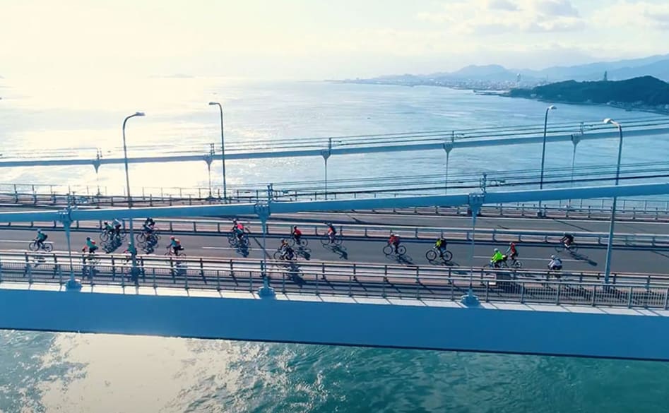
The Setouchi Shimanami Kaido Expressway (often shortened to just the Shimanami Kaido) connects the islands in the Seto Inland Sea, and is a popular route for cyclists. The Kutsuna Islands and Cape Sada are both popular spots for angling. Omogo Gorge on the clear Niyodo River and Nametoko Gorge, located upstream of the Meguro River, a tributary of the Shimanto River, are ideal for stream fishing and canyoning. Visit these and other destinations in Ehime to experience Japanese nature and the changing seasons.
-
Marvel at the beauty of the archipelago
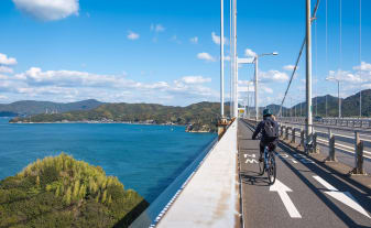
The Setouchi Shimanami Kaido Expressway connects Imabari City in Ehime Prefecture and Onomichi City in Hiroshima Prefecture. It is a 60-kilometer route that comprises the Nishi Seto Expressway, Ikuchijima Road, and Oshima Road. Of the many routes connecting the major islands of Shikoku and Honshu, this is the only one that has a path exclusively for cyclists and pedestrians. It is a popular route for cyclists worldwide because you can enjoy panoramas of the lush islands in the beautiful Seto Inland Sea while cycling on a magnificent bridge.
If you depart from Imabari City, Ehime Prefecture, the first bridge you cross on the Setouchi Shimanami Expressway is the Kurushima Kaikyo Bridge, which is about 4.1-km long. It opened in 1999 as the world's first triple-suspension bridge. From the bridge, you get a spectacular view of the Kurushima Strait and the popular Setonaikai National Park. The scenery at night is wonderfully different yet just as fantastic as during the day.
The Setouchi Shimanami Expressway crosses the scenic Seto Inland Sea and links six islands with a total of seven bridges. There are plenty of bicycle rental stations and rest areas, plus a ferry that operates along the entire route, so anyone from beginners to experts can enjoy cycling on the Setouchi Shimanami Expressway. You won't find a cycling experience like this anywhere else.
Kurushima Kaikyo Bridge
Address
Between Sunabacho, Imabari City, Ehime Prefecture and Oshima Island
Phone Number
+81 (0)782-91-1033 -
Reel in a catch on a gorgeous island
Located off the coast of western Ehime in the Seto Inland Sea, the Kutsuna Islands are made up of more than 30 different islands and are part of Setonaikai National Park.
The underwater terrain is shaped by complex currents running between the islands, and this creates an excellent environment for a wide variety of fish species. Some fish, like horse mackerel and sillago, can be easily caught, even by beginners. There are also rock fish such as red sea perch and sea ruffe, and flounders, fat greenling, black sea bream, and red sea bream. Different types of fish inhabit the waters thoughout the year, keeping anglers coming back again and again.
Among the Kutsuna Islands, there are nine inhabited islands, the largest being Nakajima Island. Various types of citrus fruits, such as mikan (mandarins), iyokan, and kara mandarins are grown on Nakajima, so it is known as the "island scented with citrus flowers". Piers at the ports of Oura, Konoura, and Nishinaka on different sides of the island, as well as the island’s beaches and rocky areas are very popular fishing spots.
Another recommended fishing spot in Ehime Prefecture is Cape Sada, Japan's longest and narrowest peninsula, located in the westernmost part of Shikoku. It is recently known as a fishing spot for big horse mackerel, but big fin reef squid, largehead hairtail, yellowtail, and red sea bream can also be found around the peninsula. It is a good spot for both families who just want to go fishing for fun and experts with their own fishing gear. If you decide to go, please respect fishing prohibited areas and no entry zones, and make sure to take your garbage with you when you leave. -
Enjoy fishing in emerald green waters
Learn moreThe Shikoku Mountains are a mountain range with an average altitude of about 1,500m. Mt. Ishizuchi, the highest mountain in western Japan, is located within this range. It is the source of the crystal clear Niyodo River which runs through Omogo Gorge, the largest gorge in Shikoku.
Both the Ishizuchi Quasi-National Park and the Omogo Shikoku Karst Natural Recreation Forest are amazingly beautiful. The quality of the water from the Niyodo River is said to be the best in Japan. It is clear, transparent, and shines an emerald green. From the promenade, you can see the white limestone of the riverbed, and fish swimming in the water. It contrasts beautifully with autumn leaves, a must-see for many visitors in the fall.
Small waterfalls and stream pools are located all around Omogo Gorge, making it the perfect environment for mountain stream fish species such as char, yamame trout, and red spotted trout. Fishers from all over the country come to reel in a big catch, trying different fishing methods such as bait fishing, fly fishing, tenkara fishing, or lure fishing, depending on the season. Omogo Gorge, with its changing scenery, is one of the most popular mountain stream fishing spots in Shikoku. Please note that mountain fishing requires a special permit issued by the Omogo River Fisheries Association, also known as the Omogogawa Gyoukyou. Please also make sure to take your garbage with you when you leave. Beginners are recommended to go with someone experienced, as some routes up the mountain stream can be dangerous.
Omogo Gorge
Address
Ishizuchi Quasi-National Park, Wakayama, Kumakogen Town, Kamiukena District, Ehime Prefecture
Phone Number
+81 (0)892-21-1111 -
Plunge down natural waterslides and waterfalls
Learn moreNametoko Gorge is located upstream of the Meguro River, a tributary of the Shimanto River and one of the three clearest streams in Japan. The name of the gorge references the river’s smooth granite bed polished over the ages by erosion. Nametoko is one of the best gorges in Ehime Prefecture. On the large rocks called "Deainame" and "Senjojiki", you can see amazing patterns formed by weathering and the various processes of the crystal-clear stream. It is definitely worth a visit.
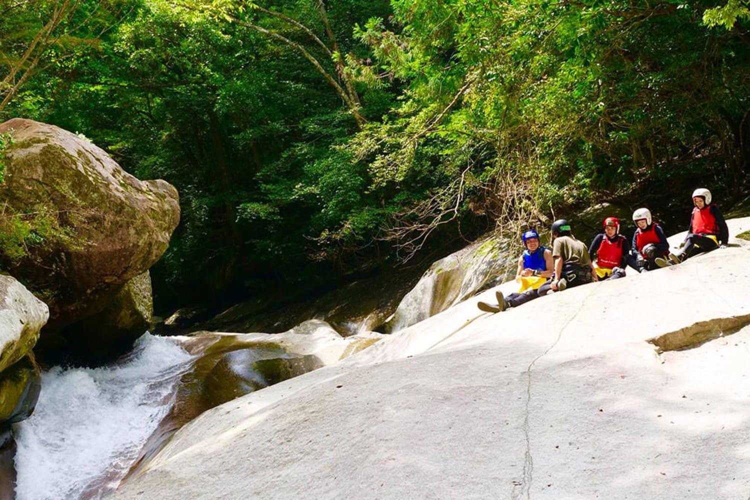
Nametoko Gorge is also the perfect place for canyoning, which is where you traverse the natural terrain of the gorge and slide down smooth rock faces. With about 12 km of terrain to explore, there are plenty of spots for sliding. There are gently-sloped drops that even children can enjoy, or natural slides with thrilling S-shaped corners. You can experience canyoning at your own comfort level.
Yukiwa Falls is a symbol of Nametoko Gorge and has been named one of the "100 Best Waterfalls in Japan." It is one of the largest natural waterslides in Japan with a total length of about 40 m. Right next to it is Ochiai Fuchi, a wonderful, naturally-formed pipe-shaped waterslide. From families to individuals looking for a challenge, the best canyoning experience awaits at Nametoko Gorge.
Nametoko Gorge
Address
Located in Nogawa, Uwajima City and Meguro, Matsunocho, Kitauwa District, Ehime Prefecture
Phone Number
+81 (0)895-42-1116
-
Scenic Views
-
Outdoor Adventure
-
Mountains & Gorges
-
Cycling
-
Lakes & Rivers
-
Coastline & Sea
-
Top Attractions
-
Summer


